Training
Coastal Inundation Mapping
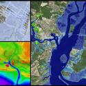
This two-day instructor-led course offers a combination of lectures and hands-on exercises to give students a better understanding of coastal inundation issues and mapping methods using a geographic information system (GIS). This course has been designed to: understand the types of inundation; learn about products and terminology; access data; perform datum conversions; understand interpolation methods and create DEMS; explore water level data; and map inundation using GIS. In hands-on exercises, students connect to web map services, access elevation data, convert between vertical datums, create and manage digital elevation models, map inundation model output, develop inundation zones, and map sea level rise using modeled tidal surfaces.
Year
2014
Details
Hazards Addressed
Assets
Difficulty
Intermediate
Format
Onsite, Instructor-Led